Enthalpy-Ltd is proud to be an official Blue Marble Geographics reseller in Greece and Cyprus. Enthalpy-Ltd is pleased to offer a variety of software applications, tools and data products for all your coordinate conversion and map data needs.
Global Mapper
Global Mapper is an affordable and easy to use GIS application that offers access to an unparalleled variety of spatial datasets and provides just the right level of functionality to satisfy both experienced GIS professionals and beginning users. Equally well suited as a standalone spatial data management tool and as an integral component of an enterprise-wide GIS, Global Mapper is a must-have for anyone who works with maps or spatial data.
- Low-cost and easy to use GIS solution
- Supports over 250 spatial data formats
- Optional LiDAR Module for powerful point cloud processing
- Advanced projection management using GeoCalc library
- Unmatched and complimentary technical support
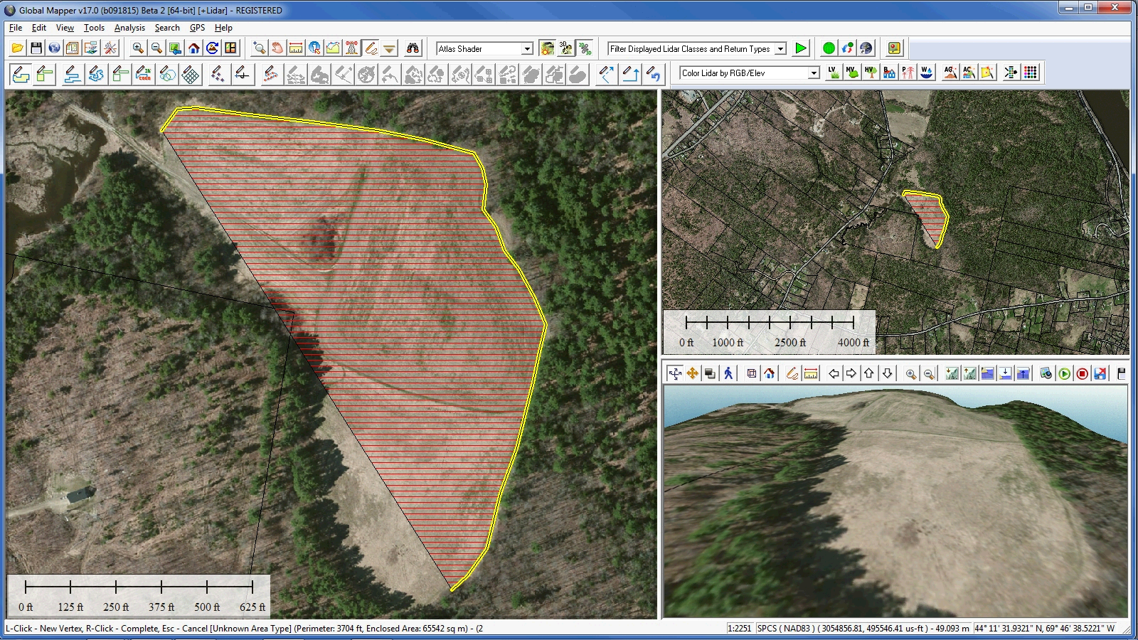
Global Mapper is more than just a utility; it offers a surprisingly extensive collection of analysis and data processing tools in a truly affordable package. Providing support for virtually every known spatial file format as well as direct access to common spatial databases, this remarkable application can read, write, and analyse all your current data.
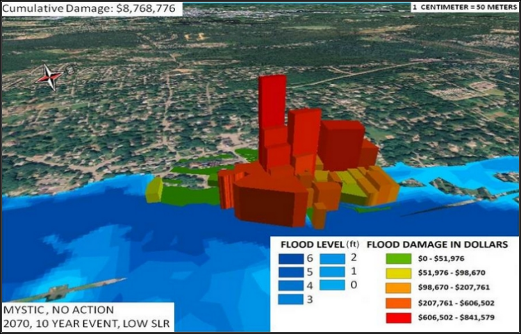
COAST (COastal Adaptation to Sea level rise Tool)
For the past two years, Blue Marble Geographics has partnered with the New England Environmental Finance Center (NEEFC) from the Edmund Muskie School of Policy Research at the University of Southern Maine to develop the software interface for COAST.
The COAST software tool, a free download, is built on the Global Mapper software developer toolkit and promoted in partnership with Catalysis Adaptation Partners.
COAST (COastal Adaptation to Sea level rise Tool) is a process that helps users answer questions regarding the costs and benefits of actions and strategies to avoid damages to assets from sea level rise and/or coastal flooding.
- Should we build a sea wall?
- Should we develop a proactive building ordinance?
- Should we build a levee?
- Should we change our zoning?
- Should we relocate?
COAST is a technical tool, but its primary added value is in how it is used. In the COAST approach, our associates at CAP help your organization or community connect technical results with the social, political, and economic realities of local adaptation, in a way that empowers stakeholders to actively engage in discussions about their future. Being entirely stakeholder driven and using locally derived data on vulnerable assets and candidate adaptation actions wherever possible.